 vesseltracker.com
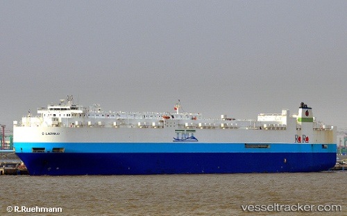
Vessel GLOVIS SOLOMON IMO: 9445409, MMSI: 441310000 Vehicles Carrier
UTC, 24.44452, 58.07973, course: 24, speed: 0
2026-01-23 22:14:18 UTC, 24.33726, 58.26021, course: 120, speed: 16.9
Live AIS position:
UTC. 41 nm N of Fahal),
updated 2026-01-23 22:14:18 UTC.
Find the position of the vessel GLOVIS SOLOMON on the map. The latter are known coordinates and path.
marine traffic ship tracker show on live map
The current position of vessel GLOVIS SOLOMON is 24.33726 lat / 58.26021 lng. Updated: 2026-01-23 22:14:18 UTCCurrently sailing under the flag of Korea (Republic of)
GLOVIS SOLOMON built in 2011 year
Deadweight:
27200 tDetails:
Last coordinates of the vessel:
UTC, 24.84761, 57.34169, course: 124, speed: 13.1UTC, 24.44452, 58.07973, course: 24, speed: 0
2026-01-23 22:14:18 UTC, 24.33726, 58.26021, course: 120, speed: 16.9